Robotic ImagingMay 2, 2022
On April 15, 2019, the Notre Dame Cathedral caught fire and its iconic spire burned, the majority of the roof was destroyed, and the upper walls were damaged. Today, the French landmark remains mangled. Part of the problem is that there were no heavily documented construction drawings or detailed drawings of Notre Dame. This horrific historic event draws attention to the fragility of heritage buildings.
In some instances, historic buildings, like the Korean gate of Sungnyemun have been heavily documented with 3D LiDAR laser scanners. As a fire ripped through Sungnyemun in 2008, this recorded data was used to reconstruct the historic landmark. An archive can save buildings and monuments, and LiDAR scanning is the perfect, highly technological solution to preserve heritage.
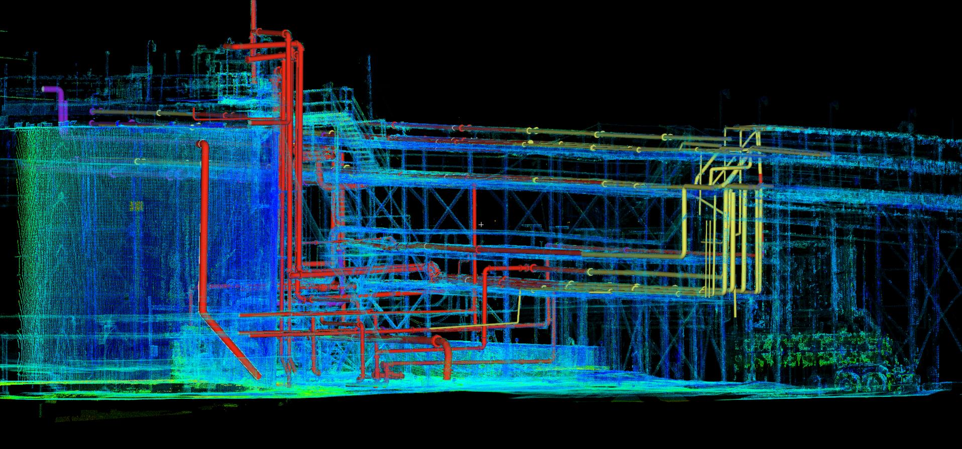
Robotic Imaging’s largest scan-to-BIM project was documenting the Glenwood Power Plant. The plant provided electricity and was constructed in 1902, expanding Grand Central Terminal’s capabilities. With over 6,000 piles driven into the earth, this power plant was constructed in the Romanesque-Revival style. Robotic Imaging’s LiDAR scan and delivered as-built model can be used to precisely document such a historic place. So, if the building were to experience a natural disaster, be grounds for human conflict, or if parts of the building further deteriorate, this hefty documentation can be used to properly reconstruct the building. Faster, highly accurate, and affordable 3D documentation techniques enable preservationists and developers to hold extensive digital records of historic buildings.
Suggested reading: If you want to learn more about Philadelhpia's urban history, check out this article.
By digitizing cultural heritage sites, scanning teams at Robotic Imaging have the capability of digitizing our built environment. This creates a digital timeline of building data that can be used for later re-construction methods, rather than starting from scratch, after a potential disaster hits a delicate site. Robotic Imaging’s mission is to safely store this data and produce an incredibly accurate model to be archived. Our clients can use this data immediately or just for safekeeping. But, as we begin to recognize the ongoing threats of heritage places, and the natural deterioration of physical structures, the time to scan is now.