Robotic ImagingMay 3, 2023
Scanning is a primary component for scan-to-BIM. But there are also other steps that you should consider. If you've ever wondered what the full scan-to-BIM workflow looks like, here's a breakdown of each step:
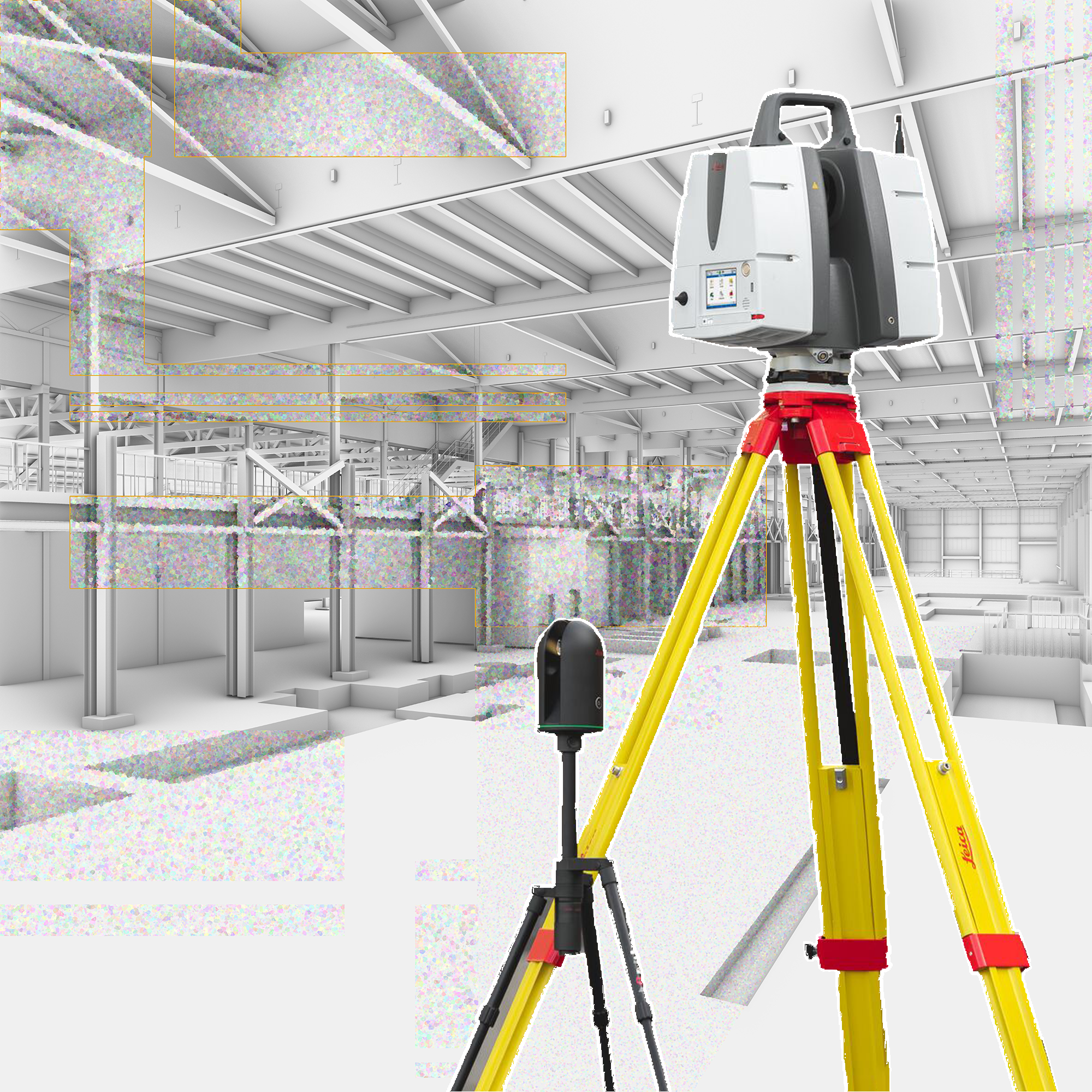
1 - Scanning
Scanning is the first step in the workflow. It can be done with a handheld scanner, drone or camera. The resulting point cloud will be used to create BIM models. When scanning, there are also other steps that you should consider. Make sure your files are in the right format and size for your BIM software. Make sure they're high resolution, too (for example: 300 ppi). Also, before you begin scanning a physical space and rooms, you have to ensure the spaces are suitable to scan. Is it safe? Is there enough light present for the scanners to get data? Are you able to access all the rooms or are some doors locked? Sometimes scanning days require a bit of intuitive planning beforehand to ensure the scan goes smoothly.
Post-scan the point cloud extracted from the site will be enhanced. This includes cleaning up geometry, removing errors from surfaces or meshes, and getting rid of outliers—these can help improve the quality of your scans so they can be used more effectively later on down the line! This clean-up work takes place back at the office to ensure our clients get a clean point cloud.
The most common type of scanning used in a scan-to-BIM workflow is photogrammetry--a process where high resolution images are taken from different angles and stitched together into one complete image (or model). This means that if you want to get started with this method, it's important for you to take pictures at several different angles so that once they've been stitched together they'll look like one cohesive picture or model.
Scan quality depends on the scanner, the software, and you. Let's break this down. Scan quality depends on:
The Scanner: The quality of your scans depends entirely on what kind of device you're using. If it can't produce high-resolution images with minimal graininess or artifacts (the little white specks that appear in low-quality images), then there's no way around it--your scans will be bad no matter what else happens during the process.
The Software: In addition to providing a platform for capturing data from physical objects into digital form, most BIM applications also include some sort of photogrammetry toolkit - basically an algorithm that helps automatically align photos taken from different angles into one 3D model based on camera positions and lens settings used during shooting.* You may want to use these tools if they're available; however keep in mind that they won't always work perfectly every time.* For example: A recent study found that many commonly used photogrammetry algorithms were unable to accurately reconstruct models when they were presented with certain types of textures (e.g., woodgrain).
You can use a variety of tools and workflows to create BIM models from point clouds—and if you have access to cloud services like Autodesk 360 or Amazon Web Services (AWS), uploading your model directly may be an option for you.
2 - Point Cloud Registration
Point clouds are created by scanning an object and capturing its geometry, which can then be used to create a 3D model. This process can be done manually or automatically by software. Manual point cloud creation involves scanning an object with a laser scanner and manually moving it around until you've captured all of its sides and angles. Automatic point cloud creation uses computer vision technology to analyze images taken by cameras mounted on drones or robots, allowing for quick scanning of large areas without having to move around as much yourself (though you may still need some practice!).
At Robotic Imaging, we use high-tech scanners that will generate a point cloud for us automatically. We are just responsible for registering the data ourselves manually. After point cloud registration is complete, we then import to Revit as an RCS file.
3 - BIM
Depending on our clients needs, we then work on translating point cloud data into BIM software such as AutoDesk Revit. In Revit, you can use a variety of tools and workflows to create BIM models from point clouds. If you have access to a cloud service like Autodesk 360 or Trimble Connect, you can upload your model directly from the cloud. If not, there are several options for a full scan-to-BIM workflow. You can use a cloud service, or you can import the data into Revit directly. Alternatively, you can create a point cloud from the scanned data and import it into Revit. Another alternative is using Point CLoud Translator. Point Cloud Translator is a free, open source tool that can be used to convert point clouds into BIM objects. It supports the IFC format, which is an industry standard for exchanging building information between different software applications. Point Cloud Translator can be used on Linux, Mac, and Windows systems.
In one's desired BIM software, a technician would begin translating data into components such as walls, floors, windows, doors, casework, and so on. This is the most time-intensive part of this journey, as it requires high fidelity to the point cloud and the details of the existing conditions.
Overall, you have multiple options for a full scan-to-BIM workflow, and this article has covered the most common ones. We recommend starting with scanning before moving on to other steps like point cloud translation or creation. If you have access to a cloud service like Autodesk 360 or Trimble Connect, you can upload your model directly from there instead of using Revit workflows at all! This can be a complicated and time consuming process. Which is why teaming up with a scan-to-BIM professional service, like Robotic Imaging, would be ideal for your project needs!

