Robotic ImagingApril 12, 2022
Why Construction Imaging is Important
As anybody in the industry knows, keeping track of a construction project of any size is quite the challenge. But we also know that tracking and documenting the process is crucial to an efficient and successful project, as well as for future references down the line. Accurate, up-to-date images of what is going on on site gives project planners the knowledge needed to make adjustments to the project, manage budgets, and estimate time to completion.
However the entirety of a project cannot be captured in one kind of image. There is many kinds of construction images, each providing a different piece of data that is part of the larger picture. Below are 5 different kinds of construction imaging and why they matter.
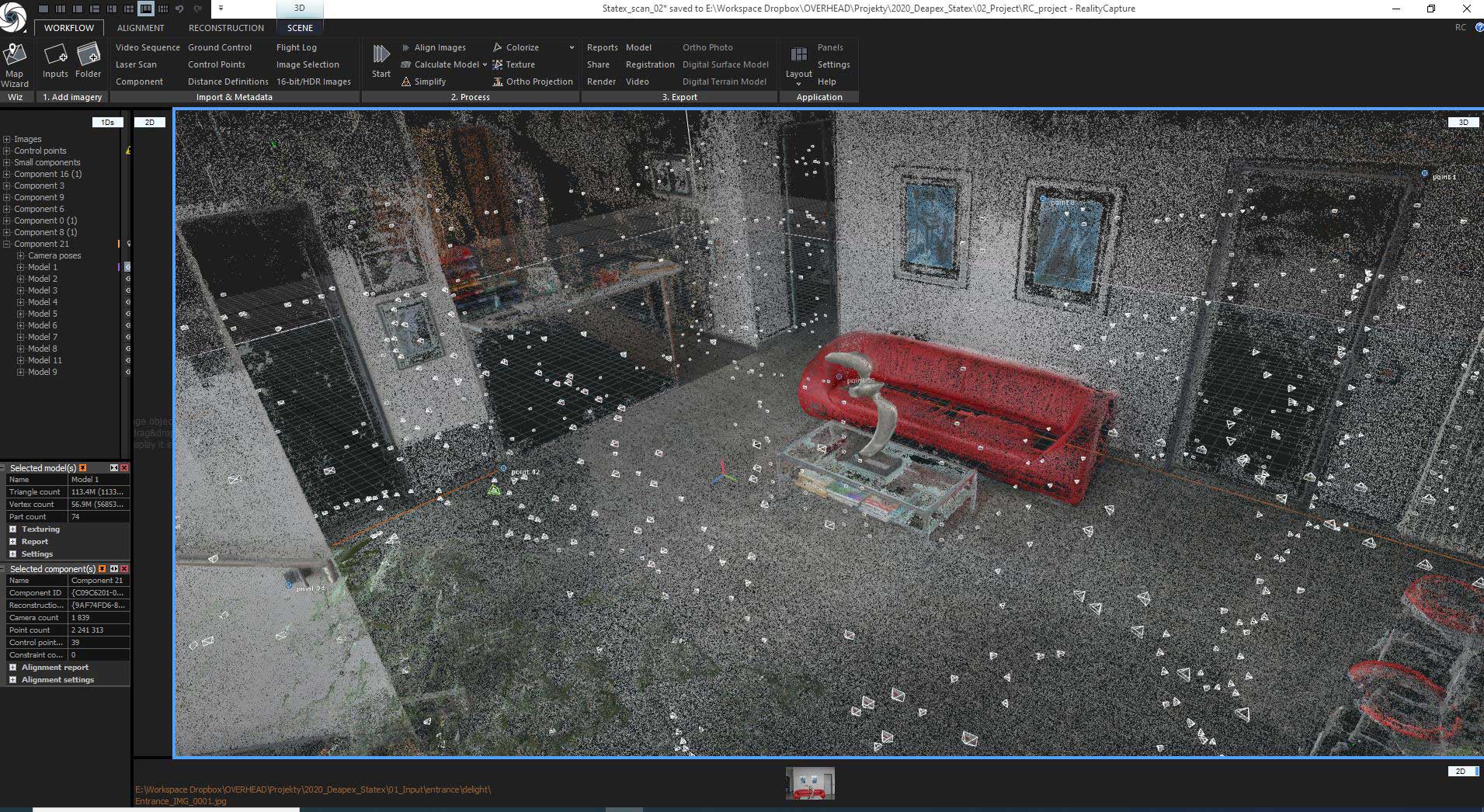
LiDAR
LiDAR (Light Detection and Ranging) uses specialized technology to collect data that represents the physical objects and outline of a 3D space. This data can be used to generate many different kinds of 3D models. These models can be used by project planners to see the exact dimensions of a space. LiDAR imaging can be captured at any point during a project to see if the work done matches the simulations created pre-project. There is so much more to say about LiDAR, but we'll leave it at that for this article. To learn more about LiDAR and the different models it can create, see our other articles about LiDAR here
Aerial Photography
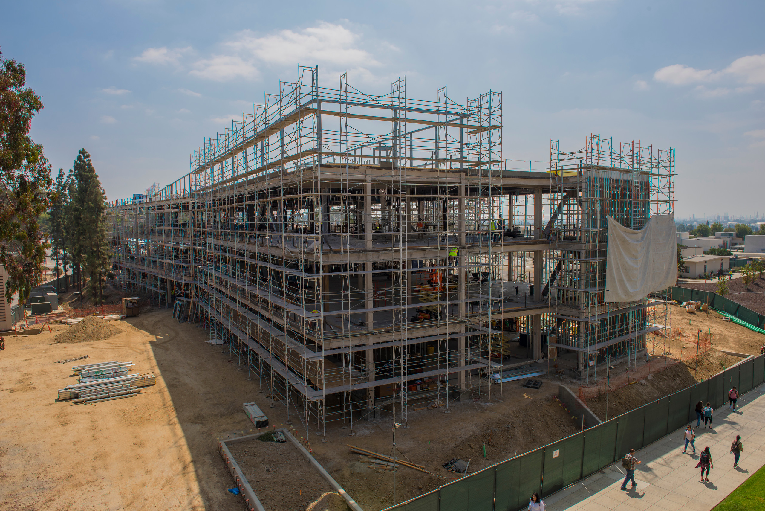
Aerial photography - photographs taken from above a construction site via drone - is another important kind of construction imaging that helps project managers visualize how a project fits into its surroundings. The advancement of drone photography technology over the past decade has given engineers and architects access to viewpoints that didn't exist in the past. This kind of photography is particularly helpful on larger projects, as they can help detect alignment miscues early on.
Virtual Reality
Virtual Reality (VR) Imaging is another construction imaging technology that has entered the scene in the past decade. Specialty cameras operated by VR technicians are able to create 360 degree images from strategic points throughout a floorplan. The result is a model that can be 'walked-through' either via screen or VR headset, allowing the user to see any part of the site from any angle. This is particularly useful to project managers that aren't able to access a site physically, but want to be able to 'look-around' for themselves without being limited to the angles and photos chosen by a traditional photographer.
Suggested reading: If you want to learn more about virtual reality services, check out this article.
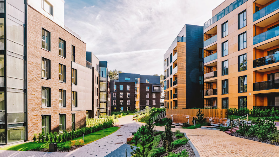
Traditional Photography
Advancements in technology that allow for VR, drone photography, and LiDAR have expanded the variety of construction imaging that project managers have access to, but that doesn't mean that there isn't still value in traditional photography. Traditional photographs are often higher resolution the VR photos, and oftentimes a constrcution photographer's expertise is valuable, especially when it comes to retail space remodeling. Having somebody walk through a space and take photos of what they know is important to a project allows an off-site manager to focus on the crucial aspects and filter out the noise.
Closing
Having access to construction imaging during a project is naturally valuable to the architects, engineers, and project managers in charge. Having access to different kinds of construction imaging and knowing the value of each is even more valuable. Robotic Imaging offers expert services in LiDAR scanning, VR imaging, traditional and drone photography. Reach out below to learn more about how we can help you on your next project.