Robotic ImagingMarch 29, 2023
A laser scanning service is a critical part of any building project. When you use a laser scanning service, you can capture an image of your building down to the smallest detail. This allows you to understand your structure and make better decisions about how to renovate or remodel it. You can also use these images as part of a construction project, which will allow you to see how everything fits together before it's built.
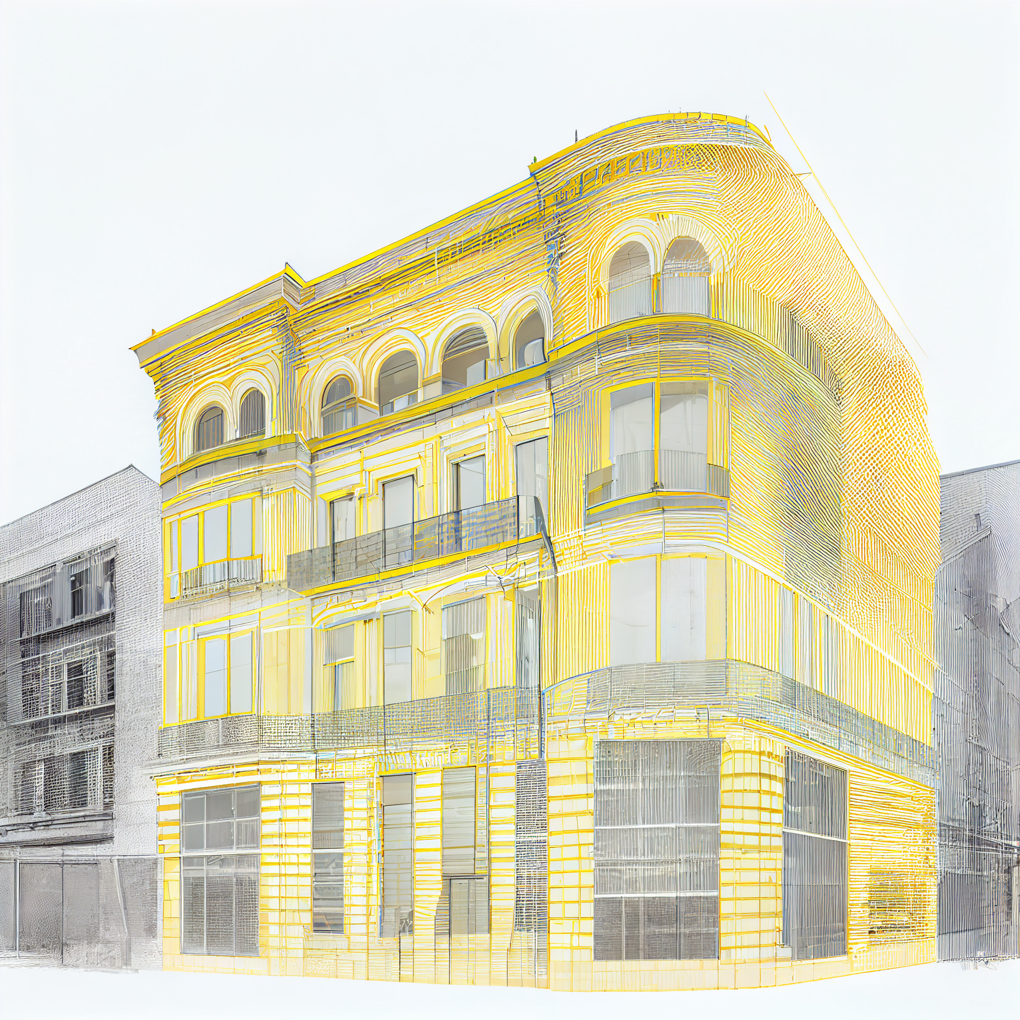
What is a Point Cloud?
A point cloud is a collection of points in three-dimensional space. A point cloud can be thought of as a 3D representation of the surface of an object. It can also be used to represent other things, such as clouds or even the stars in our universe! A single point is plotted in an X, Y, Z coordinate and will represent an underlying sampled surface. Multiple data points will collate into multiple spatial measurements and therefore can effectively represent entire interior or exterior spaces. Sometimes, additional data, like color and luminance value, can be stored in an RGB format.
Suggested reading: If you want to learn more about point clouds, check out this article.
Why Use Point Clouds for Laser Scanning Services?
A point cloud is a three-dimensional representation of a structure. It can be used to document your building and structure, as well as integrate into BIM models. There are many applications for point clouds that make them an excellent choice for laser scanning services.
What Are the Benefits of Using a Point Cloud?
Point clouds are an incredibly versatile data set. They can be used for a number of different applications, including:
- 3D modeling
- GIS analysis (geographic information systems)
- Geometric analysis
Data visualization and presentation, such as in augmented reality apps or virtual reality environments.
How Can You Use a Point Cloud as Part of Your Project?
You can use a point cloud as part of your project in a number of different ways. You could create a 3D model of your building, for example, or even create a 3D model of the structure itself. The most common use case is to turn laser scanning data into CAD drawings that can be used by engineers and architects in their projects. This is what Robotic Imaging specializes in.
A laser scanning service will use a laser scanner to scan the exterior of your building from multiple angles. The resulting data is then processed by software that converts it into a 3D image with millions of points that represent different surfaces on the surface of each object in view.
Suggested reading: If you want to learn more about the applications of point clouds, check out this article.
Overall, point clouds can be used to create accurate building information models (BIM), engineering drawings, 3D models and more.A point cloud is an excellent method for documenting your building and structure. The data collected from this process can be used in a variety of ways, including as part of an insurance claim or renovation project. However, it's important to remember that point clouds are not just limited to buildings--they can also be used on other types of structures such as bridges or even outdoor terrains like parks!